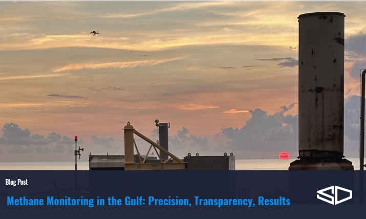
SeekOps brings precision methane monitoring to the Gulf using UAV-based quantification to deliver accurate, quantified emissions data.
Read time: 5 minutes
From offshore platforms to coastal terminals, the Gulf region presents some of the most challenging conditions for methane detection and quantification anywhere in the world. At SeekOps, we’ve brought our drone-based, in situ measurement approach to this environment, pushing the limits of precision, transparency, and field resilience. This blog highlights the work we’ve done across the Gulf, the insights gained, and how these projects demonstrate the strengths that set SeekOps apart.
Why the Gulf Matters for Methane Monitoring
The Gulf of America is one of the world’s busiest offshore energy corridors. The region’s atmospheric conditions like wind shear over open water, shifting pressure systems, and complex plume behavior make methane monitoring exceptionally difficult. Satellite, fixed wing aircraft, and fixed-sensor approaches struggle in these conditions because they cannot account for the dynamic nature of offshore airflow or atmospheric and sea conditions.
Drone-based methane monitoring in this domain requires a technology that is flexible enough to fly in shifting winds, sensitive enough to detect subtle concentration enhancements, and scientifically rigorous enough to quantify emissions in the presence of marine boundary-layer effects. SeekOps meets these requirements by capturing in situ environmental data alongside gas concentrations, enabling true top-down quantification paired with dynamic uncertainty estimation.

Key Projects & Achievements in the Gulf Region
Offshore Drone Surveys & Top-Down Quantification
SeekOps deploys UAV-based methane quantification offshore, due to its operational flexibility. From vessels and helidecks, our teams fly drones equipped with the SeekIR methane sensor and an integrated suite of environmental sensors. These flights produce a flux plane, an atmospheric slice that captures methane enhancements downwind of a platform. Because we measure wind, temperature, pressure, and stability in real time, each emission rate is associated with a transparent, physics-based uncertainty bound.
For major operators in the Gulf, SeekOps has carried out repeat surveys across more than a dozen offshore assets, providing baseline and repeat measurements with follow up survey campaigns. This follow-up approach allows operators to see how emissions change over time, and how maintenance and process optimization activities influence emission behavior. These surveys have revealed previously unmeasured emissions, clarified flare venting behavior, and validated emissions inventories under the real conditions of offshore production.
Collaboration with Major Operators
SeekOps’ work in the Gulf is part of a broader industry effort to bring consistency and scientific rigor to methane quantification. Through collaborations with major operators, Gulf platforms have become part of a wider set of routine measurement sites spanning multiple continents. This integration has helped transform early R&D-style field tests into a reliable, repeatable surveying framework.
Enhancing Sensitivity in Harsh Conditions
Operating offshore means navigating constantly shifting wind fields, marine boundary-layer turbulence, and the aerodynamic wake effects created by platform structures. These conditions can reshape a methane plume from one minute to the next. SeekOps adapts to this fluid environment by measuring all relevant variables directly at altitude, rather than relying on modeled or assumed conditions. Because the quantification model incorporates the real environmental inputs captured during the flight, emissions are neither underestimated nor overstated due to simplified meteorological assumptions. Each Gulf deployment helps strengthen SeekOps’ understanding of plume transport over water and refine its algorithms and flight paths for future missions.

Client Success Story: Building an Offshore Emissions Profile Across the Gulf
A major Gulf operator sought a measurement program that could deliver credible emissions baselines, track meaningful changes over time, and provide transparent, defensible uncertainty values for internal and external reporting. SeekOps partnered with the operator to design and execute a multi-phase offshore measurement strategy.
The baseline campaign involved UAV flights across multiple assets to establish initial emission rates. The surveys revealed persistent sources, intermittent releases, and flare behavior patterns that were not evident in bottom-up inventories. Because every measurement included a condition-specific uncertainty estimate, the operator could understand not just the magnitude of each emission but also the confidence associated with that value.
SeekOps later returned for follow up, repeat surveys. These revisit measurements proved essential in distinguishing genuine changes in emissions from weather-driven variability. On several platforms, emissions decreased after maintenance activities, and the non-overlapping uncertainty bounds between the baseline and follow-up surveys confirmed that these reductions were real. On other platforms, new intermittent sources emerged, reflecting operational adjustments that had occurred between campaigns.
With two robust datasets in hand, the operator gained a nuanced view of emissions across its Gulf assets. They could see which platforms exhibited stable behavior and which showed evolving emissions profiles. They also gained insight into how plume structure interacts with atmospheric conditions, clarifying when the data were tightly constrained and when natural variability influenced the measurement.
This depth of understanding enabled the operator to prioritize maintenance efforts, refine operational procedures, and build a transparent inventory that could withstand regulatory and ESG scrutiny. The combination of repeatable UAV flight paths, in situ environmental sensing, and dynamic uncertainty modeling transformed their emissions program from reactive to proactively data-driven.
What the Gulf Work Reveals About SeekOps’ Strengths
SeekOps’ Gulf deployments highlight the company’s ability to deliver reliable, scientifically credible methane quantification in some of the most dynamic and challenging environments. Because every measurement is grounded in what the atmosphere was actually doing at the time, operators receive data they can trust, data that reflect reality rather than assumptions. The uncertainty framework travels with the measurement, ensuring that each emission rate is as transparent as it is accurate.
These Gulf campaigns also reinforce that SeekOps’ methods fit seamlessly into regulatory and ESG frameworks. As reporting expectations shift toward defensible, quantified, measurement-based inventories, the ability to pair emission estimates with quantified uncertainty will play an increasingly central role in methane management programs around the world.
Each offshore survey also contributes to SeekOps’ continuous improvement, refining flight planning, plume modeling, and environmental interpretation. The Gulf’s complex meteorology accelerates the evolution of these tools, shaping future enhancements across all operating regions.

Charting the Future of Offshore Methane Monitoring
SeekOps’ work in the Gulf illustrates what happens when engineering excellence meets atmospheric science. By measuring where others estimate, and by quantifying uncertainty where others assume it, we are helping operators build a transparent, data-driven path to methane reduction. The Gulf is where innovation meets accountability, and SeekOps continues to set the benchmark for precision in offshore methane measurement.
References
Rodgers, C. D. (2000). Inverse Methods for Atmospheric Sounding: Theory and Practice. World Scientific Publishing.
Burton, S. P., Hair, J. W., Kahnert, M., Ferrare, R. A., Hostetler, C. A., Cook, A. L., Harper, D. B., Berkoff, T. A., Seaman, S. T., Collins, J. E., Fenn, M. A., & Rogers, R. R. (2016). Observations of the spectral dependence of linear particle depolarization ratio of aerosols using NASA Langley airborne High Spectral Resolution Lidar. Atmospheric Measurement Techniques, 9, 5555–5572. https://doi.org/10.5194/amt-9-5555-2016
Corbett, A., & Smith, B. (2022). FluxPlane Methodology for Methane Quantification. SeekOps Internal Report.
SeekOps Inc. (2024). Offshore Methane Quantification Capabilities.
SeekOps & bp Case Study. (2024). Standardizing Methane Emissions Measurement Through Drone-Based Quantification. Climate Investment.
BOEM. (2023). Offshore Oil and Gas Infrastructure in the Gulf of Mexico.
EPA. (2023). Methane Emissions and Mitigation in Offshore Oil and Gas Production.