Understanding Uncertainty – How SeekOps Quantifies Confidence

Emissions data is only useful if you know how reliable it is. Here’s how SeekOps evaluates and improves confidence in methane measurements.

Read time: 5 minutes

Why Uncertainty Matters in Emissions Monitoring

In the world of methane detection and quantification, accuracy is only half the story. Just as important, is knowing how confident you can be in your results, and that’s where uncertainty comes in.

Uncertainty isn’t a flaw in a measurement; it’s an attribute necessary for measurement transparency. In any real-world measurement, especially in a dynamic outdoor environment, there’s always going to be a degree of uncertainty. At SeekOps, we take uncertainty seriously because it gives regulators, operators, and stakeholders a clear picture of how reliable an emissions estimate really is. It builds trust, enables better decision-making, and supports compliance with high-integrity reporting frameworks like OGMP 2.0 and other global methane standards.

In short, when the stakes are high, vague numbers aren’t enough. SeekOps reports how confident we are in those results. It’s data you can act on, with confidence grounded in precision.

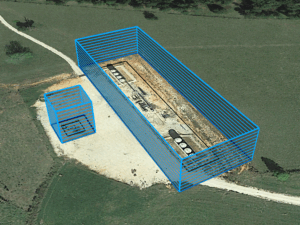
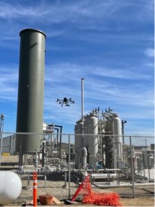
methane emissions survey at biogas facility
SeekOps measuring upgrade system emissions.

What Is Measurement Uncertainty?

Measurement uncertainty is a calculated estimate of how much the actual value could differ from the reported result. In simple terms, it’s our way of saying:

“Here’s the number—and here’s how sure we are.”

As stated above, uncertainty is not an error or a flaw. It’s a necessary part of scientific honesty and provides context to any measured value.

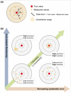
Diagram comparing accuracy, precision, and uncertainty using target-style visuals.

What Causes Measurement Uncertainty?

There are several factors that contribute to uncertainty in all top-down emissions measurements (e.g. drone, aircraft, satellite, continuous, etc.), including:

  • Sensor sensitivity and precision
    How precisely can methane concentrations be measured, especially at low levels? Sensitivity and calibration factors extend to the sensors measuring wind, temperature, pressure, and position.

  • Environmental conditions
    Wind speed and direction, turbulence, temperature, and humidity can all affect how plumes behave.

  • Plume geometry and flight path
    Complex terrain or poorly optimized flight paths can miss parts of the plume or cause the measured concentrations to be artificially lowered.

  • Background methane levels
    Differentiating the source signal from regional background can be challenging.

  • Model assumptions
    Any model-based approach requires assumptions about wind fields, dispersion, or boundary conditions which all carry their own uncertainties. However, SeekOps only utilizes a small number of assumptions due to our rigorous mass-balance approach.

SeekOps acknowledges and quantifies all of these to provide a realistic, statistically grounded picture of methane emissions.

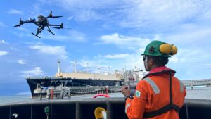
SeekOps operating in a humid marine environment in Southeast Asia.

How SeekOps Quantifies and Reduces Uncertainty

SeekOps applies a rigorous process when evaluating uncertainty in methane emissions measurements. Thanks to our ability to detect leaks as small as 0.02 kg/h, we can reliably observe virtually all measurable emission enhancements in the field. This exceptional sensitivity means that a probability of detection (PoD), a common industry metric, does not meaningfully apply, as our detection rate is effectively 100% (Ravikumar et al., 2019).

Instead of stopping at “we detected it,” we focus on how confident we are in the measured emission rate. That means identifying, quantifying, and transparently reporting the factors that influence uncertainty. Our estimation of confidence includes consideration of:

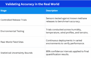
1. Controlled Release Testing

SeekOps has participated in dozens of blind controlled release trials from landfills to offshore platforms where known amounts of methane are released and measured. These trials serve as ground truth and provide hard data on the system’s accuracy and repeatability. Results consistently show SeekOps’ technology delivers low false-positive and false-negative rates and quantification within industry-accepted tolerances.

2. Environmental Profiling and Wind Modeling

Wind is one of the biggest variables in emissions monitoring. That’s why we pair our methane sensor with a 3D ultrasonic anemometer on site and apply local wind profile models, customized for each site’s surface roughness and topography.

This allows us to:

  • Understand how methane plumes move across a site

  • Improve the placement of control volumes

  • Quantify variability in wind conditions over time

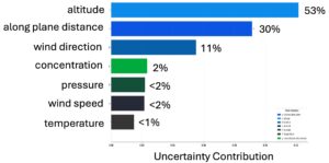
These insights are used to model uncertainty ranges for each quantification result. Recent research in Atmospheric Measurement Techniques (Mohammadloo et al., 2025) further supports this approach, showing that detailed wind profiling and adaptive plume sampling strategies are essential for reducing error margins in drone-based methane quantification.

3. Statistical Confidence Intervals

Rather than provide a single number, SeekOps delivers results with confidence bounds, typically expressed as a 95% confidence interval (2σ). This range reflects the potential variability in mass flow estimates based on real-world sampling conditions.

Incorporating uncertainty into the result isn’t just honest, it’s scientifically rigorous. It enables regulators and inventory teams to prioritize mitigation based on both emission rate and measurement reliability.

4. Cross-Site Comparisons and Continuous Improvement

With hundreds of deployments across 6 continents, SeekOps has built a robust internal benchmark of expected uncertainty under a variety of site types and conditions. We regularly update our models based on new data, seasonal trends, and learnings from large-scale campaigns like:

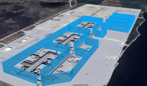
The field-validation lifecycle of SeekOps’ uncertainty estimation.

Field-Proven Performance

Our real-world uncertainty performance is validated by measured results, not estimates.

  • In complex offshore environments, like bp’s Clair Phase 1 facility, our drone-mounted methane spectrometer measured emissions within ±20% of known release rates, with detection sensitivity down to 2.5 kg/h, even from 500 m away (Smith et al., 2021; Tavner et al., 2021).

  • Independent studies at landfills and oilfields show our measurements closely match actual emissions, with agreement between platforms within 10–15% (Hossian et al., 2024; Corbett & Smith, 2022).

These results give operators the confidence that reported values reflect real conditions as opposed to modelled assumptions, enabling more reliable regulatory reporting and verification.

Transparency in Reporting

SeekOps integrates uncertainty bounds directly into reports and dashboards, whether through emission rate ranges (e.g., “12.4 ± 3.1 kg/h”), confidence classification for each source, documentation of assumptions and environmental conditions, or repeatability scoring across revisits or campaigns.

This transparency is essential for high-integrity emissions inventories and meets emerging global standards for ESG and methane reporting like OGMP 2.0 or the new EU Methane Regulation.

Reducing Uncertainty Over Time

Our measurement platform improves with every flight.

As we collect more field data, refine our models, and adjust flight strategies based on terrain and weather, we continually reduce our uncertainty margins, giving customers increasing confidence in our results.

We do it with the use of site-specific wind profiles from on-site anemometers, adaptive flight patterns to capture full plume geometry, real-time quality control during flight operations, and machine learning models to predict and minimize measurement error in complex environments.

Toward a More Confident Climate Future

As the world moves toward net-zero goals and increasingly rigorous climate disclosure frameworks, uncertainty isn’t a liability: it’s a strength.

By quantifying uncertainty, SeekOps empowers operators to prioritize mitigation based on both scale and confidence, communicate transparently with regulators and the public, and build robust emissions inventories that stand up to scrutiny.

Because in the end, reducing emissions isn’t just about knowing there’s a leak, it’s about knowing how much, how sure, and what to do next.

Stay tuned for the next post in our series: “Drone Deployment and Site Mapping – Smarter Surveys Start from the Sky.” And look out for our blog post covering dynamic uncertainty in the coming weeks!

Want to learn how SeekOps quantifies uncertainty and improves confidence in your methane data?

Ask us about our uncertainty and speak with an expert today

Image Credits

Figure 1 from Pérez-Díaz, L., Best, J., Gómez-Martín, F., Hodgson, D., Lang, A., Mather, A., McCarthy, D., & Thorpe, R. (2020). Introduction: Handling uncertainty in the geosciences: identification, mitigation and communication. Solid Earth, 11, 889–897. https://doi.org/10.5194/se-11-889-2020 — Licensed under CC BY 4.0.

References

Corbett, A., & Smith, B. (2022). Study of a Miniature TDLAS System Onboard Two Unmanned Aircraft to Independently Quantify Methane Emissions from Oil and Gas Production Assets and Other Industrial Emitters. Atmosphere, 13(5), 804. https://doi.org/10.3390/atmos13050804

Dawson, K. W., Smith, B. J., Stocker, I., & Evans, P. (2024). Assessing the Application of Drone TDLAS Methane Emissions Monitoring Technology in the Intertropical Convergence Zone Using Machine Learning. APOGCE 2024. https://doi.org/10.2118/221317-MS

Gully-Santiago, M. A., Smith, B., Frederick, T., Dawson, K., & Elliott, D. (2025). Results and Learnings from the TADI 2024 Methane Quantification Trial. SPE Europe Energy Conference and Exhibition. https://doi.org/10.2118/225634-MS

Hossian, R. I., et al. (2024). A Controlled Release Experiment for Investigating Methane Measurement Performance at Landfills. Environmental Research and Education Foundation (EREF). https://erefdn.org/eref-funded-study-highlights-advances-in-measuring-landfill-methane-emissions

Mohammadloo, T. H., Jones, M., Van De Kerkhof, B., Dawson, K., Smith, B. J., Conley, S., et al. (2025). Quantitative estimate of sources of uncertainty in drone-based methane emission measurements. Atmospheric Measurement Techniques, 18, 1301–1325. https://doi.org/10.5194/amt-18-1301-2025

Ravikumar, A. P., Sreedhara, S., Wang, J., et al. (2019). Single-blind inter-comparison of methane detection technologies – results from the Stanford/EDF Mobile Monitoring Challenge. Elementa: Science of the Anthropocene, 7(1), 37. https://doi.org/10.1525/elementa.373

Smith, B. J., Buckingham, S., Touzel, D., et al. (2021). Development of Methods for Top-Down Methane Emission Measurements of Oil and Gas Facilities in an Offshore Environment Using a Miniature Methane Spectrometer and Long-Endurance UAS. SPE Annual Technical Conference and Exhibition. https://doi.org/10.2118/206181-MS

Tavner, C. A., Touzel, D. F., & Smith, B. J. (2021). Application of Long Endurance UAS for Top-Down Methane Emission Measurements of Oil and Gas Facilities in an Offshore Environment. SPE Offshore Europe Conference and Exhibition. https://doi.org/10.2118/205467-MS

Turning Data into Insight – Quantifying Emissions with Accuracy

See how SeekOps calculates emissions using real-time methane concentration and wind data, based on conservation of mass.

Read time: 5 minutes

Why Measuring Emissions Matters

Finding a leak is only half the story, knowing how much is leaking is what truly makes a difference.

In the world of emissions monitoring, quantification refers to the process of calculating how much methane is being released, by volume or mass, from a facility or piece of equipment. Whether it’s a small valve or a large storage tank, understanding the magnitude of a leak is critical for regulatory reporting, prioritizing repairs, and making informed decisions on environmental performance.

With climate regulations like OGMP 2.0 and EU MR being enforced more rigorously, and ESG targets growing more ambitious, accurate quantification isn’t just helpful, it’s essential.

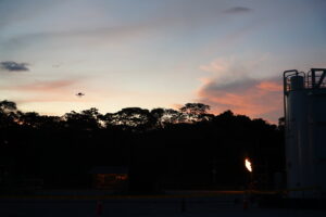
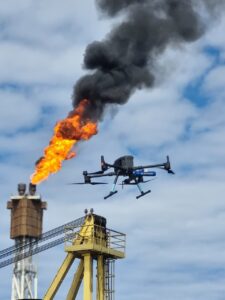
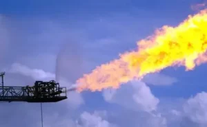
Flare boom in operation

From Sensing to Sizing: How It Works

SeekOps begins with drone-based surveys using our SeekIR® methane sensor. The drone flies a planned pattern over the site while continuously collecting real-time concentration measurements of methane in the atmosphere.

But detecting methane in the air doesn’t immediately tell us how much is being released at the source. We leverage a combination of advanced tools, including on-site wind measurements from ground sensors and real-time wind data collected directly by the drone’s onboard anemometer. This integration ensures that our quantification is based on actual wind conditions rather than assumptions which is a critical distinction that enhances accuracy, particularly in complex or variable environments. That’s where quantification algorithms come in.

We use a combination of:

  • Atmospheric modeling (to account for wind and dispersion),

  • Sensor positioning data (to locate the plume in 3D space),

  • Concentration readings (to measure the strength of the signal),

  • and flight telemetry (to understand how the drone moved during measurement).

We collect this data using our drone-mounted sensor and a high-resolution 3D anemometer placed on site. Then we apply proven mathematical models to turn those data points into a mass flow rate that is usually expressed in grams per second or standard cubic feet per hour.

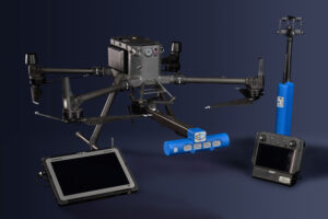
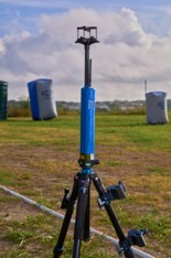
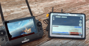
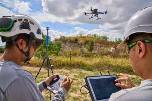
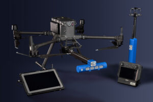
Field demonstration with all the necessary equipment to detect and quantify methane.

It’s Not Guesswork: It’s Physics

Quantifying emissions involves applying principles of fluid dynamics, gas dispersion modeling, and mass balance equations. Think of it like reverse-engineering a puzzle: we see the effects in the air and work backward to figure out what kind of leak caused them.

Key considerations include:

  • Plume height and width

  • Ambient wind speed and direction

  • Stability of atmospheric conditions

  • Distance from the source

Our system adapts in real-time to changing field conditions and uses validated models that have been peer-reviewed and tested at facilities like METEC (Methane Emissions Technology Evaluation Center).

Using the Law of Conservation of Mass

Our measurements rely on a simple, powerful idea: what goes in must come out.

We define an invisible box, or “control volume”, around a facility or piece of equipment. By measuring the air and wind conditions upwind and downwind of this box, we can calculate the difference in methane and determine how much is leaking inside.

This approach is grounded in the conservation of mass, one of the most fundamental laws in physics.

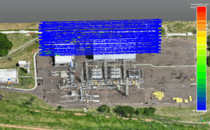
3D visualization of a flux plane interpolated downwind of an offshore platform, integrating atmospheric dispersion data with site-specific emissions to pinpoint methane release zones in real time.

Accuracy You Can Trust

At SeekOps, we’re proud that our quantification system has been third-party validated in blind testing environments, peer-reviewed in academic literature, and deployed in over a dozen countries and diverse climates.

Each SeekIR® sensor undergoes rigorous calibration and environmental validation, including testing across humidity (0–95% RH) and temperature (-20°C to 55°C) ranges. This ensures the system performs in extreme field conditions, whether in Arctic oilfields or equatorial landfills.

In independent comparisons, SeekOps has consistently demonstrated low measurement uncertainty and high repeatability, even for low-level emissions.

Scalable and Repeatable Data

One of the key benefits of our quantification process is that it’s repeatable over time. This allows facility operators to track emissions reductions after repairs, compare performance across assets or regions, demonstrate emissions improvement for ESG reports or regulatory compliance, and plan maintenance around the highest-volume sources first.

SeekOps leads the industry in application of these approaches with regard to the standardization of workflows, enabling compliance with a wide variety of initiatives globally. By turning emissions into measurable trends, we help our partners move from reactive to proactive emissions management.

Supporting Methane Intensity and Reconciliation

SeekOps quantification feeds into broader metrics like Methane Intensity (MI) or reconciliation of emissions to various, complex emission sources. With accurate site-level data, operators can benchmark performance, calculate carbon equivalencies, and report to frameworks like OGMP 2.0, EU MR, or EPA GHGRP.

Our quantification data can also support reconciliation with bottom-up inventories and mass balance models. This enables companies to align measurement-based and inventory-based methods more effectively, which is crucial for verification and audit-readiness.

Quantification Is Climate Action

The ability to quantify methane accurately transforms environmental responsibility from a guess into a guarantee. With SeekOps, operators gain the clarity to prove performance, meet compliance, and reduce emissions at scale—enabling operators to produce energy sustainably and responsibly. Every leak quantified is a step toward a cleaner, more transparent energy future.

Stay tuned for the next post in our series: “Understanding Uncertainty – How SeekOps Quantifies Confidence.”

Ready to turn emissions data into actionable insights?
Schedule a Walkthrough or Learn About Our Quantification Methods

Image Credits

Ken Doerr, Methane Emissions from Oil Tank, Flickr, Creative Commons Attribution 2.0 Generic (CC BY 2.0).

Equation Formula Math Physics Science Poster, Wallpaper Flare.

References

Corbett, A., & Smith, B. (2022). Study of a Miniature TDLAS System Onboard Two Unmanned Aircraft to Independently Quantify Methane Emissions from Oil and Gas Production Assets and Other Industrial Emitters. Atmosphere, 13(5), 804. https://doi.org/10.3390/atmos13050804

Mohammadloo, T. H., Jones, M., Van De Kerkhof, B., et al. (2024). Quantitative Estimate of Sources of Uncertainty in Drone-Based Methane Emission Measurements. https://doi.org/10.5194/egusphere-2024-1175

Dawson, K. W., Smith, B. J., Stocker, I., & Evans, P. (2024). Assessing the Application of Drone TDLAS Methane Emissions Monitoring Technology in the Intertropical Convergence Zone Using Machine Learning. APOGCE 2024. https://doi.org/10.2118/221317-MS

Hanson, R. K., Spearrin, R. M., & Goldenstein, C. S. (2016). Spectroscopy and Optical Diagnostics for Gases (Vol. 1). Springer. https://link.springer.com/book/10.1007/978-3-319-23252-2

Ravikumar, A. P., Wang, J., Sreedhara, S., et al. (2019). Single-blind inter-comparison of methane detection technologies: Results from the Stanford/EDF Mobile Monitoring Challenge. Elementa: Science of the Anthropocene, 7(1), 37. https://doi.org/10.1525/elementa.373

Capturing the Invisible – Methane Plumes in Motion

Discover what methane plumes are, how they form, and why detecting them matters for climate change, regulatory compliance, and sustainability goals.

Read time: 5 minutes

Invisible Emissions with Big Consequences

You can’t see methane with your eyes, but that doesn’t mean it’s not there.

Methane is a colorless, odorless gas that escapes from oil and gas operations, landfills, wastewater plants, and agricultural sites around the world. When it leaks into the atmosphere, it often forms what’s known as a plume, a drifting cloud of methane that moves and disperses with the wind.

These plumes can vary in size, shape, and intensity, but they all represent unaccounted emissions, and in many cases, significant sources of greenhouse gases. Methane is over 80 times more potent than carbon dioxide at trapping heat over a 20-year period, which makes its early detection and quantification a critical tool in mitigating climate change.

So, What Exactly Is a Plume?

A plume is simply a section of air where methane concentrations are higher than normal due to a nearby emission source.

Think of it like smoke from a fire: as methane leaks out of equipment or piping, it gets caught in the wind and begins to drift. This creates a “cloud” of gas, but unlike smoke, methane is invisible to the naked eye.

The size and direction of a plume are influenced by several things such as wind speed and direction, atmospheric temperature and humidity, terrain and structures (buildings, tanks, trees), and emission rate and duration.

Because of these variables, plumes can be short and dense, or long and diffuse. And unless you have specialized equipment, they can go completely unnoticed.

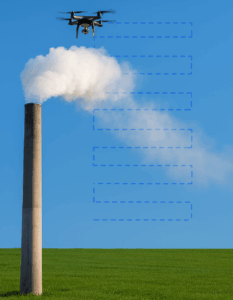
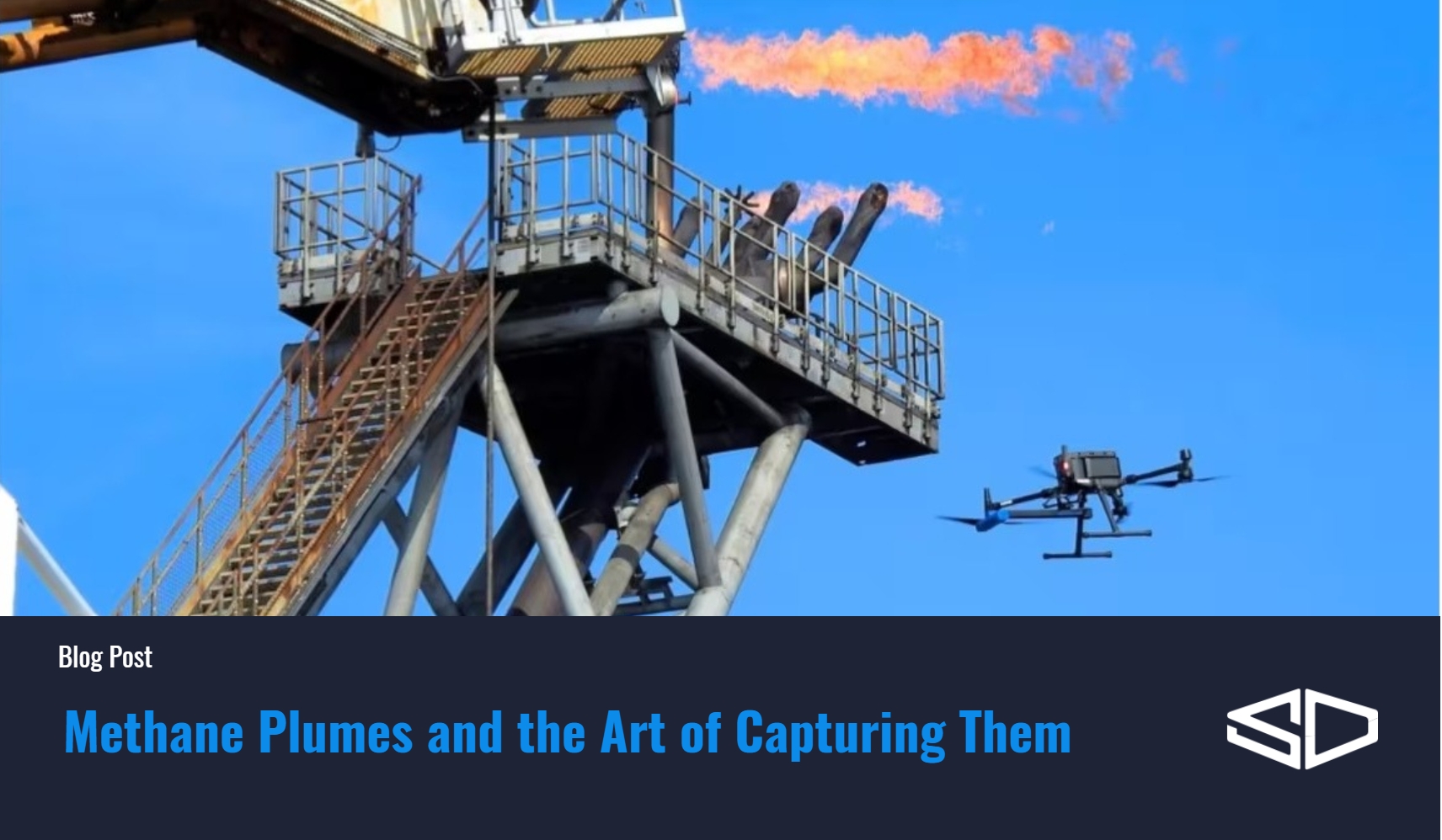
Visual of emissions plume.
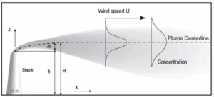
Gaussian Plume Model Diagram.

How Plumes Are Detected

Detecting a methane plume requires remote sensing technology, or tools that can scan the air in place and identify gas concentrations without needing to interfere with industrial operations.

SeekOps uses a highly sensitive laser-based sensor mounted on drones. The sensor works using wavelength modulation spectroscopy, which allows us to “see” the methane in the air by measuring how laser light is absorbed as it passes through the gas.

Our drones fly over facilities in planned patterns, creating a 3D map of methane concentration in space and time. This not only identifies the plume but also helps trace it back to its source.

A top-down illustration of methane puffs as an unmanned aerial vehicle (UAV) moves through the plume.

Going Where Others Can’t

Our drones can fly close to sources (like tanks and flares) without interfering with operations, over uneven terrain and over water, which is nearly impossible for ground teams, and at high altitudes, sometimes up to 50 meters above the ground, to catch the full vertical profile of the plume.

The drone systems are equipped with anti-collision sensors, pre-programmed flight paths, and built-in no-fly zones. Meaning we can safely conduct surveys without flying over people or sensitive equipment.

By being mobile, we can adapt to changing winds, reach difficult areas, and make sure no emission goes unnoticed.

Where Do Methane Plumes Come From?

Methane plumes can come from a wide variety of sources, including:

  • Oil and gas equipment (leaky valves, tanks, pipelines)
  • Abandoned or orphaned wells
  • Landfills and composting sites
  • Wastewater treatment plants
  • Biogas and RNG facilities
  • Agricultural operations (especially manure and rice cultivation)

Sometimes, plumes form from routine operations such as tank venting or flaring. Other times, they result from accidental or fugitive leaks. Either way, detecting and quantifying these plumes is the first step toward managing and reducing emissions.

Visualization of how air flows impact the movement of methane plumes.

What Plumes Tell Us

Each plume tells a story.

A small, consistent plume might indicate a slow leak from a valve. A large, concentrated plume could point to a sudden release or equipment failure. In some cases, operators may not even know a leak exists until it’s detected by an aerial survey.

By mapping the plume’s shape and location, we can estimate where it started and how fast methane is escaping.

This data is crucial for regulatory reporting, operational efficiency, safety, and ESG compliance.

Why Plumes Matter for Climate and Compliance

Methane is responsible for nearly 30% of global warming to date, and many governments are introducing stricter rules to reduce emissions across industries.

Plume detection helps meet these regulations in several ways:

  • Verifiable Measurement: Proves that you know your emissions footprint.
  • Source Identification: Supports root cause analysis and repair.
  • Trend Tracking: Shows whether emissions are increasing or decreasing over time.
  • Reporting Accuracy: Backs up regulatory submissions with real data.

And beyond compliance, every plume that’s identified and stopped means fewer greenhouse gases in the atmosphere and less lost product, translating to cost savings and climate benefits.

What We Do with the Data

Once a plume is detected and mapped, SeekOps converts the raw methane concentration measurements into quantitative emissions estimates. These estimates tell operators exactly how much methane is escaping—not just that a leak exists.

We also integrate this data into dashboards and analytics tools that can be used by field technicians, operations managers, and ESG teams. Combined with GPS coordinates, timestamps, and wind data, plume tracking becomes a powerful decision-making tool.

Making the Invisible Visible

In the fight against climate change, one of the biggest challenges is invisible emissions. Methane plumes are real, measurable, and impactful, but only if you know where to look.

With the SeekIR® sensor and drone-based measurements, SeekOps helps customers visualize, quantify, and eliminate emissions that would otherwise go unnoticed.

From compliance to climate responsibility, understanding methane plumes is a key step toward a lower-emissions future.

Next up: “Turning Data into Insight – Quantifying Emissions with Accuracy.”

Think your facility might benefit from drone-based emissions mapping?
Talk to a Specialist or Get a Sample Survey Report.

Image Credits

Plume dispersion diagram: Adapted from U.S. Environmental Protection Agency (EPA), AERMOD: Description of Model Formulation, EPA-454/R-03-004. Retrieved from https://www.epa.gov/scram/air-quality-dispersion-modeling-preferred-and-recommended-models

Industrial smokestack with visible emissions: Image by Christine Matthews. Retrieved from Geograph UK: https://s0.geograph.org.uk/geophotos/03/22/03/3220320_1df4aa5c.jpg

References

Corbett, A., & Smith, B. (2022). Study of a Miniature TDLAS System Onboard Two Unmanned Aircraft to Independently Quantify Methane Emissions from Oil and Gas Production Assets and Other Industrial Emitters. Atmosphere, 13(5), 804. https://doi.org/10.3390/atmos13050804

Smith, B., Buckingham, S., Touzel, D., et al. (2021). Development of Methods for Top-Down Methane Emission Measurements of Oil and Gas Facilities in an Offshore Environment Using a Miniature Methane Spectrometer and Long-Endurance UAS. Paper presented at the SPE Annual Technical Conference and Exhibition, Dubai, UAE. https://doi.org/10.2118/206181-MS

Tavner, C.A., Touzel, D.F., & Smith, B.J. (2021). Application of Long Endurance UAS for Top-Down Methane Emission Measurements of Oil and Gas Facilities in an Offshore Environment. Paper presented at the SPE Offshore Europe Conference and Exhibition, Virtual. https://doi.org/10.2118/205467-MS

Webster, C. R. (2005). Measuring methane and its isotopes 12CH₄, 13CH₄, and CH₃D on the surface of Mars with in situ laser spectroscopy. Applied Optics, 44(7), 1226–1235. https://doi.org/10.1364/AO.44.001226

Dawson, K. W., Smith, B. J., Stocker, I., & Evans, P. (2024). Assessing the Application of Drone TDLAS Methane Emissions Monitoring Technology in the Intertropical Convergence Zone Using Machine Learning. In APOGCE 2024 (p. D031S020R003). Perth, Australia: SPE. https://doi.org/10.2118/221317-MS

Gully-Santiago, M. A., Smith, B., Frederick, T., Dawson, K., & Elliott, D. (2025). Results and Learnings from the TADI 2024 Methane Quantification Trial. Paper presented at the SPE Europe Energy Conference and Exhibition, Vienna, Austria. https://doi.org/10.2118/225634-MS

The Science of Precision – How the SeekIR Sensor Works

Understanding how light, lasers, and a bit of aerospace science help us measure methane with exceptional accuracy.

Read time: 5 minutes

Detecting Methane with Light

How do you “see” a gas that is invisible to the naked eye?

That’s the challenge our team set out to solve with the SeekIR® sensor. Methane is colorless and odorless, but it interacts with specific wavelengths of light in a very predictable way. When laser light passes through a plume of methane, any methane molecules in the way will absorb some of the light. By measuring how much light gets through, we can determine how much methane was present. This technique is called absorption spectroscopy, and it allows us to measure methane with exceptional precision, down to parts per billion. That’s like spotting a single drop of ink in an Olympic-size swimming pool.

This optical approach is powerful because it’s non-contact and extremely fast, making it ideal for mobile platforms like drones.

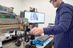
Construction of the SeekIR® Sensor at our on-site lab.

The Basics of Absorption Spectroscopy

Imagine shining a flashlight through a fog. Some of the light makes it through, and some gets absorbed by the tiny water droplets. By measuring how much light is absorbed, you can learn something about what’s in the fog.

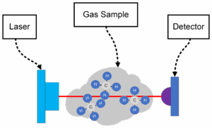
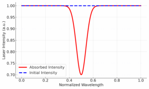
In our case, instead of a flashlight, we use a Tunable Diode Laser (TDL) that emits light at a specific wavelength that methane molecules are known to absorb. And instead of fog, we’re looking through air that may or may not contain methane. If methane is present, it will absorb some of the laser light, and our detector on the other side will see a dip in the signal.

Drawing of the sensor operating principle of laser absorption spectrometry to determine methane concentration.

This process is described by the Beer-Lambert Law, a physics equation that helps us calculate exactly how much methane is in the air based on how much light was absorbed. This is the same principle used in laboratories, but we’ve miniaturized and ruggedized it for use in real-world environments on unmanned aerial systems (UAS).

Graph displaying light absorption (reduction in laser intensity) due to interaction with methane molecules.

Building a Better Sensor

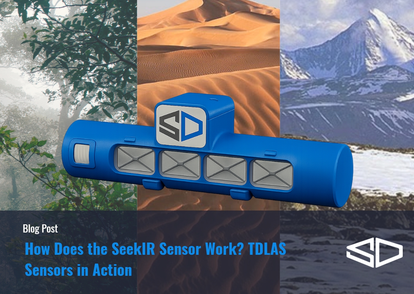
Not all sensors are created equal. While laser spectrometers exist on the market, the SeekIR® sensor was engineered for maximum sensitivity and durability, combining aerospace-grade optics with field-ready design.

To boost sensitivity, the SeekIR® sensor uses a special design called a Herriott Cell, a key feature to the design. Think of it like a hall of mirrors, our laser bounces back and forth between two highly reflective surfaces, giving it a longer path to interact with any methane molecules in the air. The longer the path, the more chances we have to detect even tiny amounts of gas.

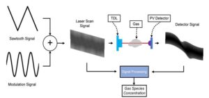
We also use a technique called Wavelength Modulation Spectroscopy (WMS). This method “tunes” the laser rapidly across a small range of wavelengths, helping us cut through background noise and measure only what we care about. It’s like tuning a radio to the exact frequency of your favorite station while filtering out static. This means our readings are both more accurate and more robust, even when environmental conditions aren’t ideal.
Simplified drawing of the implementation of Wavelength Modulation Spectroscopy (WMS) using a tunable diode laser (TDL) for gas sample diagnostics.

 Built for Real-World Conditions

Sensitive scientific instruments are usually delicate or don’t hold up in the field, but this one is different.

We perform a rigorous multi-point calibration of each sensor in our laboratory, allowing it to maintain high accuracy across a broad dynamic range of methane concentrations. This step is critical to ensure the sensor produces consistent, quantitative data, regardless of whether it’s detecting a small background enhancement or a significant leak event.

Following calibration, each sensor is placed in an environmental chamber where it’s subjected to controlled humidity conditions ranging from 0% to 95% relative humidity (RH). This ensures the sensor’s optical and electronic systems remain stable even in highly variable weather conditions.

The sensor’s robustness is further confirmed through temperature validation tests between -20°C and 55°C, simulating the harshest real-world environments, from frozen oilfields to tropical biogas facilities. These extremes are not hypothetical—they reflect the demanding conditions our clients face across global field deployments.

Additionally, it’s ruggedized for the harshest environments. The ruggedization is verified through the shock and vibration testing completed at our factory. Confirming it’s ready to operate around the world in a variety of winds, temperatures, and high altitudes without missing a beat.

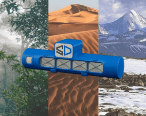
The SeekIR® sensor can and has operated in a variety of these harsh environments.

Why Precision Matters

In emissions monitoring, small errors can lead to big consequences.

When you’re trying to quantify emissions that can change rapidly with weather or equipment conditions, precision is everything. An error of just a few parts per million could mean the difference between reporting a small leak or missing a much larger one. Operators may delay repairs, regulators may receive incomplete data, and companies may miss emissions targets. That’s why precision isn’t just a nice-to-have, it’s a requirement.

Once calibrated in the factory, our laser-based sensor doesn’t require recalibration in the field and maintains its accuracy over time even after extended use. That gives us and our customers confidence in the data we collect, whether it’s being used for regulatory reporting, sustainability goals, or leak detection and repair (LDAR) programs.

A Foundation for Smarter Decisions

By precisely measuring methane in the air, the SeekIR® sensor forms the backbone of our measurement system. It tells us when methane is present, how much there is, and helps guide our drone flights to find the source.

And while the technology might be based on sophisticated optics and physics, the goal is simple: give companies a reliable way to see what was once invisible—and take action.

In our next post, we’ll explore how methane behaves in the atmosphere and why mobility (like flying a drone) is key to understanding emissions in three dimensions.

Stay tuned for the next post in our series: “Capturing the Invisible – Methane Plumes in Motion.”

Want to learn how precise methane detection helps reduce emissions?
Contact Us to discover how SeekIR® can support your environmental goals.

References

Hanson, R. K., Spearrin, R. M., & Goldenstein, C. S. (2016). Spectroscopy and Optical Diagnostics for Gases (Vol. 1). Springer. https://link.springer.com/book/10.1007/978-3-319-23252-2

Webster, C. R. (2005). Measuring methane and its isotopes 12CH₄, 13CH₄, and CH₃D on the surface of Mars with in situ laser spectroscopy. Applied Optics, 44(7), 1226–1235. https://doi.org/10.1364/AO.44.001226

Corbett, A., & Smith, B. (2022). Study of a Miniature TDLAS System Onboard Two Unmanned Aircraft to Independently Quantify Methane Emissions from Oil and Gas Production Assets and Other Industrial Emitters. Atmosphere, 13(5), 804. https://doi.org/10.3390/atmos13050804

NASA Spinoff (2019). Methane Detector Sniffs Out Leaks. NASA Technology Transfer Program. https://spinoff.nasa.gov/Spinoff2019/ps_7.html

From Martian Methane to Methane Reduction: The Origin of SeekOps Technology

Discover how SeekOps turned a Mars rover methane sensor into a powerful emissions monitoring tool—precision built for space, used to reduce climate change on Earth.

Read time: 5 minutes

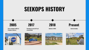
Timeline on the Evolution of SeekOps

A Journey That Began on Mars

At SeekOps, our technology has a rather extraordinary origin story. Long before it was detecting methane leaks at energy facilities, the core sensor behind our platform was developed to help search for life on Mars.

Yes, that Mars.

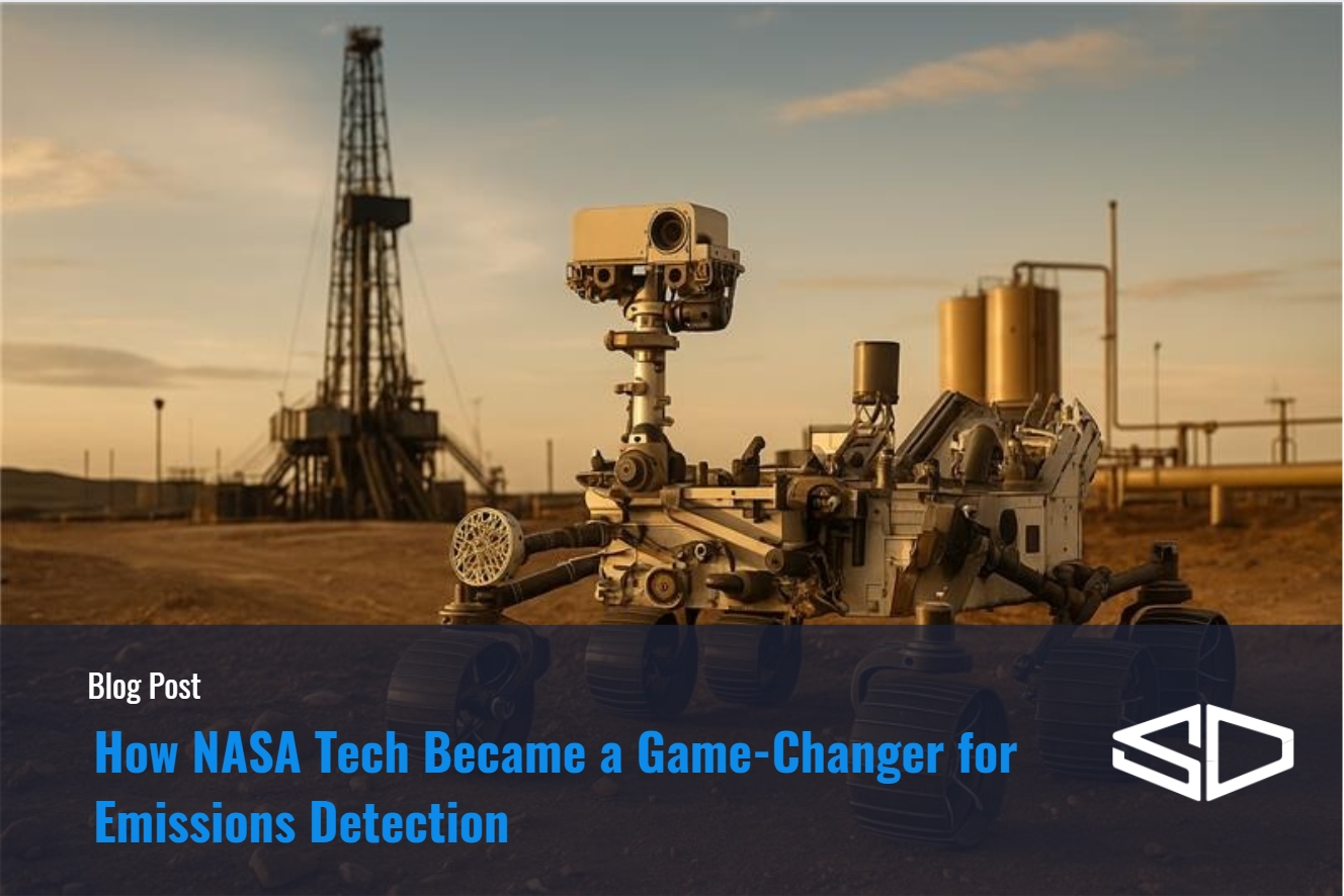
Our sensor was born at NASA’s Jet Propulsion Laboratory (JPL) as part of the Curiosity Rover mission. Scientists needed a tool sensitive enough to detect even the smallest traces of methane, a gas that on Mars could be a clue pointing toward microbial life. Because Mars has only tiny amounts of methane in its atmosphere, the instrument had to be extremely precise and accurate with the ability to pick up even the faintest signal.

What the JPL team didn’t foresee was how this breakthrough would later be used to tackle one of Earth’s most pressing climate challenges — methane emissions monitoring. That same core technology is now the foundation of SeekOps’ globally deployed sensor systems, helping industries detect and reduce greenhouse gases with unprecedented accuracy.

Transforming Space-Tech into Climate-Tech

After being successfully deployed on another planet, the methane detection technology was “spun out” of NASA in 2017 and adapted for use in our own atmosphere. That’s when SeekOps was born.

Our team saw enormous potential: methane is a powerful greenhouse gas, more than 80 times more potent than carbon dioxide over a 20-year period, resulting in a huge impact for the climate. It is responsible for about 30% of current global warming, according to the International Energy Agency. Because it dissipates faster than CO₂ in the atmosphere, cutting methane offers one of the fastest, most impactful ways to slow climate change in the near term.

Detecting and reducing emissions is a priority across the energy industry and beyond. Yet, until recently, many tools lacked the sensitivity or mobility to measure it effectively, especially in hard-to-reach places or dynamic environments such as oil and gas facilities, landfills, biogas plants, and more.

SeekOps set out to change that. Adapting the Martian sensor for terrestrial use required more than a simple repackaging. Earth’s atmosphere is denser, more humid, and far more variable than that of Mars, demanding significant engineering adaptations. The SeekOps team miniaturized the platform even further, integrated it with unmanned aerial systems (UAS), and reconfigured it for accurate measurements in industrial settings. They also developed fully autonomous workflows that allowed the sensor to be deployed at scale — from drones surveying oil and gas facilities to quantification and attribution workflows in the cloud.

The result is a compact yet powerful methane detection tool that blends space-grade precision with the practicality and flexibility required for global emissions monitoring.

Field-Tested. Field-Proven.

Bringing the sensor down to Earth wasn’t enough—we needed to prove it works in real-world conditions. That’s why we took it to the Methane Emissions Technology Evaluation Center (METEC) in Colorado.

Our sensor was one of the first methane detection platforms evaluated at METEC, a controlled test facility that simulates real-world emission scenarios. The sensor performed exceptionally well, with results showing high sensitivity and consistent quantification accuracy across a range of emission rates and environmental conditions. Our sensor outperformed the rest, detecting leaks without false positives or false negatives.

Independent evaluations, including those conducted by Stanford University and industry-leading operators, confirmed the technology’s reliability. Unlike many alternatives, SeekOps’ system not only detected emissions at very low levels but also provided accurate quantification, even in the presence of wind, obstructions, or multiple sources.

These capabilities have led to wide adoption by major energy companies, government programs, and climate accountability initiatives, reinforcing SeekOps’ position as a trusted partner in methane detection.

Real-World Impact Around the Globe

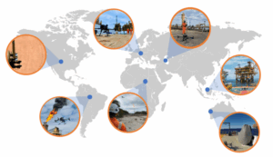
Since its commercialization, SeekOps has surveyed more than 2,000 facilities across over 35 countries and six continents, including over 100 offshore platforms. The technology has been deployed in a wide range of sectors: from upstream and midstream oil and gas operations to renewable natural gas projects, landfills, biogas digesters, and waste management sites.

Each deployment provides detailed, site-specific emissions data that customers use to make operational improvements, address leaks, and comply with stringent climate regulations. The results speak for themselves. Since 2021, SeekOps has enabled the measurement of over 1.1 million tonnes of methane annually, equivalent to about 31 million tonnes of carbon dioxide. These measurements support programs such as OGMP 2.0 and the EU Methane Regulation, as well as new frameworks such as GTI Veritas, OneFuture, or MiQ in the United States.

SeekOps doesn’t just provide detection — it enables action.

Why It Matters

Methane detection isn’t just about compliance. It’s about protecting our environment and improving operational safety. Every undetected leak is a lost resource and a missed opportunity to reduce climate impact. While it often escapes through small leaks or malfunctioning equipment, it has historically been difficult to detect and measure, especially at scale.

Because our sensor was designed to operate in one of the harshest environments imaginable—another planet—it’s incredibly reliable and sensitive. That means SeekOps can detect and quantify even low-level emissions in complex, real-world conditions.

By turning invisible emissions into actionable insights, operators can now locate even small leaks, prioritize repairs, and demonstrate measurable reductions. This capability is no longer a “nice-to-have,” but a core requirement for companies that are serious about reducing their carbon footprint and meeting regulatory or ESG expectations.

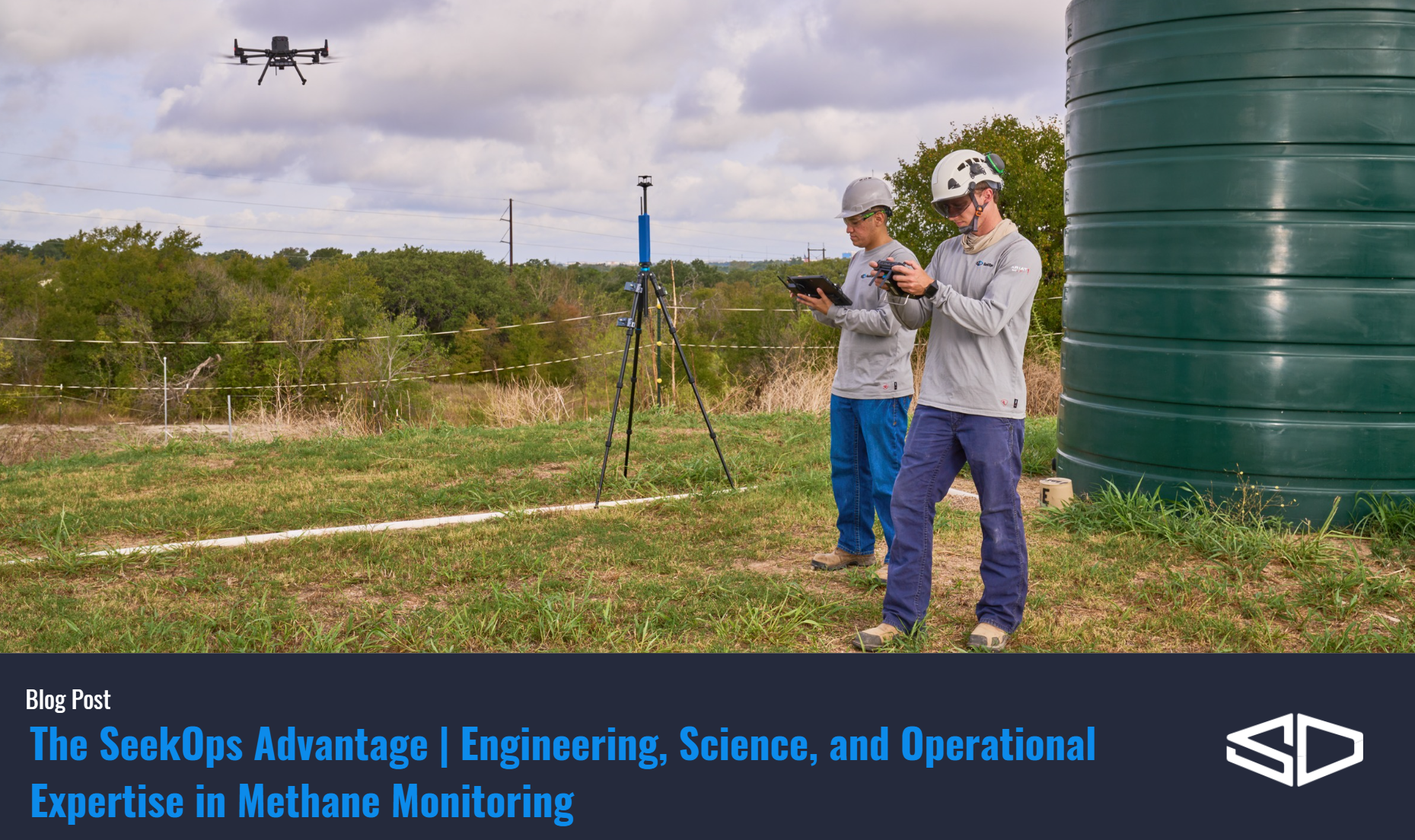
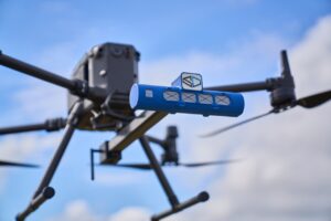
SeekOps Equipment Up Close and in Action

From Red Planet to Blue Planet

Today, what started as a mission to find life on Mars is helping us preserve life here on Earth.

SeekOps is proud to carry that legacy forward by combining scientific rigor, cutting-edge technology, and environmental stewardship to support industries in their efforts to reduce emissions and build a more sustainable future. Our company is expanding its sensor platform to detect other greenhouse gases like carbon dioxide. It is also developing AI-powered analytics to automate emissions source attribution and support predictive maintenance. All of this aims at making emissions data even more useful, and actionable, for customers.

As the world continues to embrace transparency, accountability, and decarbonization, SeekOps is committed to providing the tools that enable real change. Whether you’re new to emissions monitoring or an industry veteran, we’re excited to share how our tools work and why they matter.

Stay tuned for the next post in our series: “The Science of Precision – How the SeekIR® Sensor Works.”

Curious how space-age tech can improve sustainability on Earth?
Request a Demo or Explore Our Technology to see how SeekOps is transforming emissions monitoring around the world.

References

Webster, C. R. (2005). Measuring methane and its isotopes 12CH₄, 13CH₄, and CH₃D on the surface of Mars within situ laser spectroscopy. Applied Optics, 44(7), 1226–1235. https://doi.org/10.1364/AO.44.001226

NASA Spinoff (2019). Methane Detector Sniffs Out Leaks. NASA Technology Transfer Program. https://spinoff.nasa.gov/Spinoff2019/ps_7.html

Ravikumar, A. P., Wang, J., Sreedhara, S., et al. (2019). Single-blind inter-comparison of methane detection technologies: Results from the Stanford/EDF Mobile Monitoring Challenge. Elementa: Science of the Anthropocene, 7(1), 37. https://doi.org/10.1525/elementa.373

Hossian, R. I., et al. (2024). A Controlled Release Experiment for Investigating Methane Measurement Performance at Landfills. Environmental Research and Education Foundation (EREF). https://erefdn.org/eref-funded-study-highlights-advances-in-measuring-landfill-methane-emissions

Corbett, A., & Smith, B. (2022). Study of a Miniature TDLAS System Onboard Two Unmanned Aircraft to Independently Quantify Methane Emissions from Oil and Gas Production Assets and Other Industrial Emitters. Atmosphere, 13(5), 804. https://doi.org/10.3390/atmos13050804